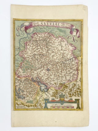
Circulus sive Liga Sveviae
[Antwerp]: Dated 1572 [but between 1608 and 1612]. Hand colored engraved map, 12 5/8 x 9 7/8 inches image, 16 1/2 x 10 5/8 inches sheet. Crossed arrows watermark. A fine map from Ortelius's atlas showing Lake Constance, the Danube and Rhine. Bounded by the Lech, Odenwald, Alsace and Chur.....